Zone Lookup

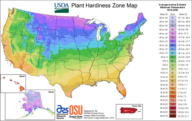
The 2012 USDA Plant Hardiness Zone Map is the standard by which gardeners and growers can determine which plants are most likely to thrive at a location. The map is based on the average annual minimum winter temperature, divided into 10-degree F zones.
The map is available as an interactive map, or you may simply type in a zip code and find the hardiness zone for that area.
Although these zones are useful as an indictor of a plant's likelihood for survival in a given area, many factors, including soil type and fertility, soil moisture and drainage, heat, humidity, rainfall and exposure to sun and wind determine a plant's growth and success or failure in its environment.
Areas above an arbitrary elevation are traditionally considered unsuitable for plant cropping and do not bear appropriate zone designations. There are also island zones that, because of elevation differences, are warmer or cooler than the surrounding areas and are given a different zone designation.
Note that many large urban areas carry a warmer zone designation than the surrounding countryside. The map contains as much detail as possible, considering its size and the vast amount of data on which it is based.
Please note:
- Hardiness zones are a general indication of cold hardiness and are not exact. Elevation and other factors may affect suitability of certain plants, we suggest that you consult your local cooperative extension, a local landscaper, or garden center if you are in a fringe zone.
- Recommendations for sun and shade planting are included to help you choose plants for your specific location. In the south, some plants listed as full sun can be more difficult to establish than in cooler climates.
 (0)
(0)